Thursday, August 5, 2010


View Piers in Philadelphia in a larger map


Which stages of the path of goods into and out of Philadelphia are responsible for pollution? How? Who is affected by that pollution?

The stages which cause pollution are the ones which release toxins and chemicals into our environment. The transport ships dump oil into the water while trucks and trains release fumes into the atmosphere. This effects everything, such as humans, plants, animal, nature, etc..

-John, Shanice, and Nasir
Friday, July 30, 2010

Water testing along the rivers


View Water Testing 2 in a larger map

As we went on field trips to Penns Landing and the Fairmount Water Work Museum, water samples were collected and tested.

Thursday, July 22, 2010

Water Testing on the Parkway

As we went on our field trip along the Ben Franklin Parkway we collected water samples from each of the fountains. Today we preformed water tests on each of the five samples, testing for pH, NO3-, NO2-, and Ammonia. Here is the map created by the students of where the fountains are and the test results.


View Water Testing in a larger map

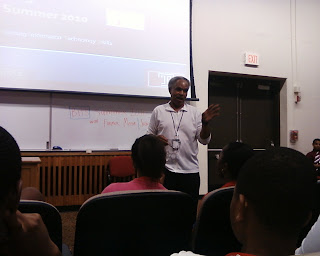
Former Mayor John Street

Yesterday Former Mayor John Street came to talk to BITS! He was very entertaining and taught a good lesson to the BITS participants. His main focus was on staying focused and working hard so that each individual can achieve his/her dream. Being a North Philadelphia resident himself, Mayor Street related to many by telling his stories of his neighborhood, how he grew up, and how his determination lead to his many successes. It was an inspirational speech!

Wednesday, July 21, 2010

Philadelphia Museum of Art


Yesterday we visited the Philadelphia Museum of Art! The students got a chance to observe some of the paintings and interpret how landscapes were portrayed. Before our trip, the students researched the museum. Here is John's work:

The Philadelphia Museum of Art (built in the early 1870’s, years before the Benjamin Franklin Parkway, which was under construction between 1917-1926) is one of the countries largest museums, and holds some of the worlds most beautiful and renown master pieces, although it wasn’t until the early 1900’s that reconstruction was done to make it into the museum which we see today. The museum was built on a hill at the end of the Benjamin Franklin parkway ( the past location of columns of houses) , and although I can’t say for sure why they originally built it there, it is positioned perfectly as the high light of the Benjamin Franklin Parkway. The design of the museum which we see today was due to the visual genius of architect Horace Trumbauer and Julian Abele (who finished the designs after Trumbauer’s death.)

A Trip to the Benjamin Franklin Parkway

Last week our group went on a field trip to the Ben Franklin Parkway, along the Schuylkill River. We observed the statues and the sculptures along the Parkway. As we walked, we picked up leaves from the trees and later identified what types of trees were planted in that area. In Logan Circle the students collected water from the fountain to be tested. After our long walk we got a chance to go into the Rodin Museum, where we observed the sculptures.

Here are some of the maps made by the students that show some of the features that we saw and visited along the Parkway:

Ninaflore's Map:

View The parkway in a larger map

John's Map:

View Benjamin Franklin Parkway in a larger map

Thursday, July 15, 2010

Wissahickon Valley Park

We will be heading to the Wissahickon Valley Park this coming week! Here is some information on the history and current situations within the park: